Bondo Street View Project
In much of the developing world, Google has sent it's vehicles to cover most major cities and towns worldwide with Street View 'Blue Lines', which indicate those streets which have a series of 360° panoramas connected together in a navigable 'Virtual Tour'.
Sadly, though, much of the rest of the developing world remains un-covered, and in Kenya, Google managed only the major highways and big towns like Nairobi, Mombasa, Kisumu and Nakuru. The rest of the country has no hope of coverage in the near future.
Or maybe not.
Enter Places and Premises 360™ and #bondostreetviewproject .
Starting in March 2020, following the first Covid-19 outbreak and lockdown, I was essentially locked down in Bondo with nothing to do except take short walks for the sake of fitness. I carried along my trusty Samsung Gear 360 camera, and later a Ricoh Theta 'V' as I charted out short sections of streets and paths and uploaded the footage to Google Street View.
This soon became a habit and I've been taking longer walks covering more and more of the road network within a 5km radius of Bondo Town.
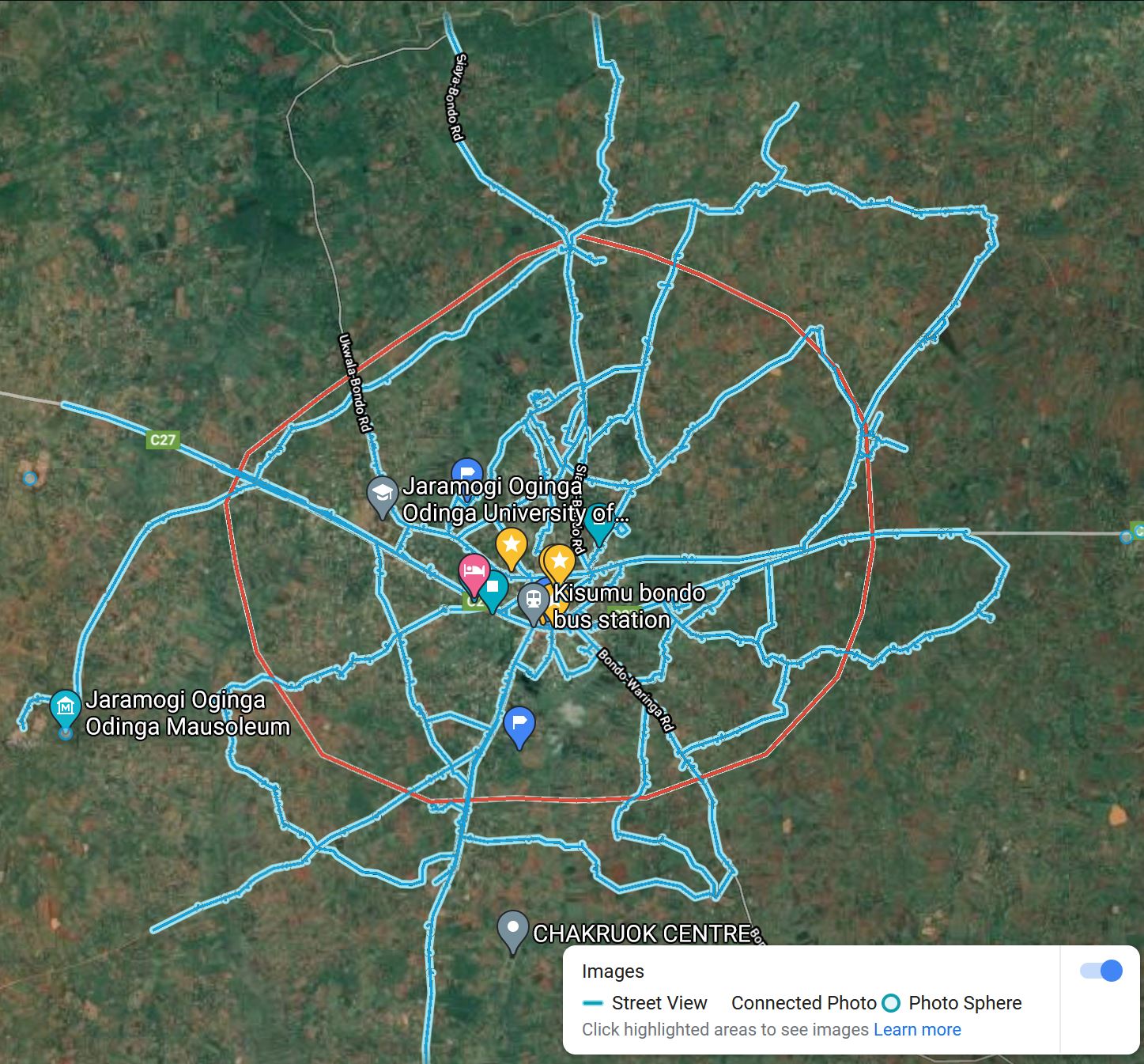
The featured image shows all the Streets of Bondo Town & Environs with Blue Lines (i.e. paths with connected 360° imagery). This is the coverage that the Bondo Street View Project has achieved so far. It is a work in progress.
